 N-Ways
 N-Ways in The Gambia
Find any place in The Gambia.
Search a place, a business or a Plus Code address in Banjul, Serekunda, Brikama or Basse and N-Ways takes you to the door, by car or on foot. It knows the taxi and gele-gele fares in dalasis, the Senegambia Bridge toll, and the ferry from Banjul to Barra.



- Capital
- Banjul
- Money
- D Dalasi
- Clock
- GMT UTC+0, all year
- Drives on the
- Right
- Language
- English Mandinka, Fula and Wolof widely spoken
- Toll for a car
- D200 Senegambia Bridge
What works in The Gambia
From Banjul to Basse, on one map.
N-Ways covers the whole country on one map, both banks of the river. Here’s what you get when you open it in The Gambia.
Search by name or Plus Code
Places, streets and businesses in every region. In Banjul and Kanifing a Plus Code on the building’s address board is its official address: type it, or the name of the place.
Turn-by-turn, in English
Spoken directions, lane arrows and road signs, with the region you’re in shown on the map, like “West Coast · The Gambia”.
Taxi and gele-gele fares
What a ride should cost in dalasis: town-trip and shared yellow taxis, gele-gele minibuses and seven-seaters, from the fares set after the April 2026 increase.
Fuel in dalasis
Tell N-Ways your car once and every trip shows its litres and what they cost at the pump price, D109.80 a litre of petrol since 1 September 2026.
Phone numbers, new and old
Mobile numbers have nine digits since 4 September 2026. Type an old seven-digit number and N-Ways saves it the new way, with its 87, 83 or 86.
Help after a crash
N-Ways shows the numbers to call, 116 for an ambulance, 117 for the police and 118 for fire and rescue, and says to check them locally.
Main towns
The capital and the regions’ main towns. Search any of them, or a street or business inside.
- Banjul Banjul
- Serekunda Kanifing
- Brikama West Coast
- Farafenni North Bank
- Soma Lower River
- Janjanbureh Central River
- Basse Upper River
Checked 18 October 2026. Sources: The Point (fares), Gambiana (fuel, September 2026), PURA (numbering plan), ICTD (Kanifing addresses), Government of Canada (emergency numbers), Wikipedia (languages).
The river
Across the Gambia River by ferry or by bridge.
The river splits the country in two. From Banjul the ferry crosses to Barra and the North Bank; upriver, the Senegambia Bridge at Farafenni carries the Trans-Gambia Highway. Choose Boat in Directions and N-Ways plans the way to the terminal, the crossing and the way on; by car it takes the bridge and shows the toll.
- Banjul–Barra ferry: Gambia Ferry Services, for cars and foot passengers, about 30 minutes across, with a sailing about every half hour when the fleet runs. About D25–35 on foot; expect queues for cars.
- The Senegambia Bridge: D200 for a car, D50 for a motorcycle or taxi, since 15 October 2022.
- Upriver: the Janjanbureh and Bansang ferries, with no published timetable. Avoid wooden pirogue crossings.


Checked 18 October 2026. Sources: Gambia Ferry Services, Gambiana (bridge tariff), Wikipedia (Senegambia Bridge), UK FCDO.
Home codes
A home code beside every Plus Code.
Your Plus Code stays your official address. Beside it, the name of your town or village and a short number, unique in the whole country: Bakau 2389 is easy to say on the phone and leads a taxi or a courier to your gate.
Open N-Ways at home, tap Get my code, and share it in one tap.
Get my code Read the research paper
For developers: look codes up, find the code at a point or decode them with the home codes API guide. No key is needed.
Host it yourself: every code, the areas, the engine and a ready-made server are open at github.com/n-ways/open-addresses-gambia, free to run on your own servers under their licences (data ODbL 1.0, engine Apache 2.0). Credit when you use it: N-Ways Addressing for The Gambia, © N-WAYS LIMITED (nways.ng)
 Kanifing
Borders
Into The Gambia from Senegal.
- From Dakar: Karang to Amdalai on the coast road, then the ferry from Barra to Banjul.
- Dakar to Casamance: Keur Ayip to Farafenni, the Senegambia Bridge, then Soma to Sénoba: the shortest way to Ziguinchor.
- From Ziguinchor: Séléti to Giboro, on the road to Brikama and Serekunda.
- Bring a passport, ECOWAS ID card or travel certificate, a yellow fever card, and for the car its papers and an ECOWAS Brown Card. Same clock, GMT, on both sides.
Checked 18 October 2026. Sources: UK FCDO, WHO (yellow fever), OpenStreetMap (border posts).
What N-Ways does in The Gambia
Every screen here is the real app in The Gambia. Swipe through each row.
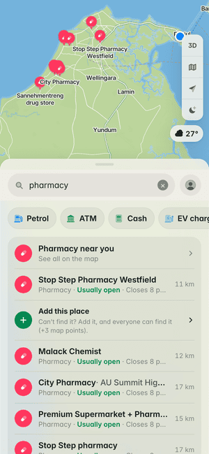
Find what’s near
Pharmacies around Banjul, with their opening hours.
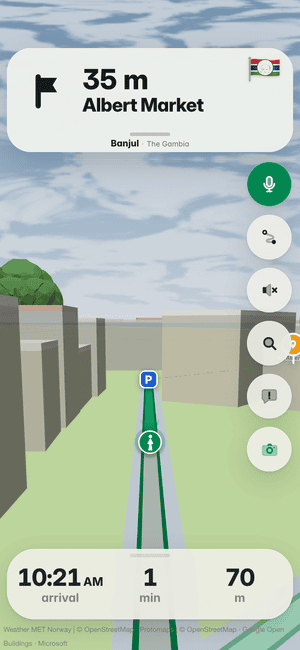
Right to the door
The last metres on foot, to the entrance of Albert Market.
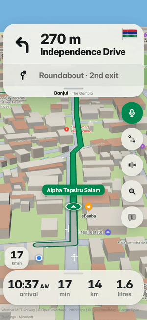
Turn-by-turn in Banjul
Every turn called with the street’s own name, on Banjul’s roads.
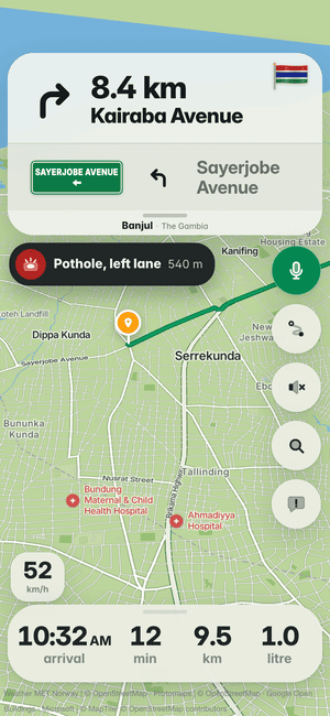
Potholes, lane by lane
Know which lane the pothole is in before you reach it, across Banjul.
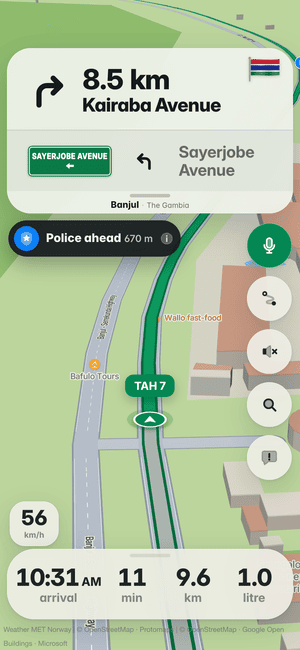
Police ahead
Other drivers’ reports warn you before a checkpoint in Banjul.
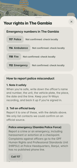
Your rights in The Gambia
The Gambia’s emergency numbers and where to report misconduct, one tap away.
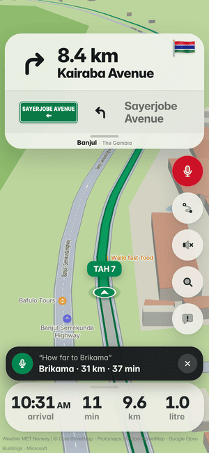
Ask while you drive
“How far to Brikama?” Tap the mic and ask, in English or French.
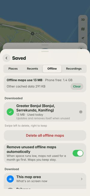
Maps without data
Download Banjul once and the map works with no signal.


What it fixes for you, free.
The everyday problems of getting around, and what N-Ways does about each. No subscription, no account needed.
“Call me when you reach the junction.”
Addresses that don’t exist on any map. Search a postcode, a digital address or a landmark, and N-Ways walks you to the door.
See howData finished halfway there.
Save the map for offline use and keep going with no signal. It tidies itself when storage is short.
See how
Works with Apple CarPlay.
Connect your iPhone and N-Ways opens on your car’s screen: the same map and voice as on the phone, with big buttons made for driving. A trip you started on the phone carries on in the car.


The next turn onto Ikorodu Road with its green road sign, fuel for the trip in litres and the arrival time.
The map turns dark when your car switches to night.
Each route’s time and distance before you set off, then Go.
Bad road ahead, in time to slow down.
Places, businesses and postcodes, picked from a list.
Look around, then one tap brings the map back to the car.
Shown on a drive in Lagos.
- Turn by turn
- The distance, the road’s name and its green sign, and on iOS 18 the lane to be in.
- Spoken directions
- Through the car’s speakers, turning your music down while it talks.
- Warned in time
- Potholes, bad road, crashes, traffic lights, tolls and borders ahead. “Still there?” takes one tap.
- Find your way there
- Places, businesses and addresses, or Home, Work and your recent trips.
- Pick your route
- Time and distance for each before you go, and a faster way offered on the road.
- Report from the wheel
- Crash, police, traffic, roadworks, hazard or closure, from six big buttons.
Part of the N-Ways app for iPhone. You need an iPhone and a car with CarPlay.
Also on iPhone, in testing: your next turn, the road sign and your lane on the Lock Screen and in the Dynamic Island.
Your trips, your data.
Your trips stay yours
We don’t sell where you go, and ads never get your trip history.
No account needed
Search and drive without signing in. Sign in only to keep places and points on another phone.
Recordings stay on your phone
A checkpoint video is never uploaded unless you choose to back it up.
Delete it all
Remove your account and everything in it at any time. Privacy policy
Building an app for The Gambia?
The N-Ways Maps Platform: the maps, address search and routes behind the app, as APIs and SDKs for the web, Android and iOS. Free calls every month, then prices in your own currency.
Your business, on the road to it.
A short billboard shows to drivers heading your way, only when they’re stopped or slow, never near a turn. Pay for the days you choose.
Questions about N-Ways in The Gambia
How do I find an address in Banjul or Serekunda?
Search by the name of the place, street or business, or type a Plus Code: in Banjul and Kanifing the Plus Code on a building’s address board is its official address. N-Ways covers every region, on both banks of the river.
How much is a taxi in The Gambia?
N-Ways shows what a ride should cost in dalasis, as a rough guide: town-trip and shared yellow taxis, gele-gele minibuses and seven-seaters, from the fares set after the April 2026 increase, and your fuel at the pump price, D109.80 a litre of petrol since 1 September 2026.
How do I take the ferry from Banjul to Barra?
Choose Boat in Directions and N-Ways plans the walk to the terminal, the crossing and the way on. Gambia Ferry Services carries cars and foot passengers, about 30 minutes across, with a sailing about every half hour when the fleet runs; about D25–35 on foot, and expect queues for cars.
How much is the Senegambia Bridge toll?
D200 for a car and D50 for a motorcycle or taxi, since 15 October 2022. By car N-Ways takes the bridge at Farafenni and shows the toll on the route.
My contacts have seven-digit numbers. Does N-Ways understand them?
Yes. Mobile numbers in The Gambia have nine digits since 4 September 2026; type an old seven-digit number and N-Ways saves it the new way, with its 87, 83 or 86.
What number do I call after a crash in The Gambia?
N-Ways shows 116 for an ambulance, 117 for the police and 118 for fire and rescue, and says to check them locally.
Is there a free GPS app that works offline in The Gambia?
N-Ways is free, and it can save a city for when there’s no signal; maps you stop using tidy themselves away when your phone runs low on space. The map works in your browser at map.nways.ng.
How do I drive into The Gambia from Senegal?
From Dakar, cross from Karang to Amdalai on the coast road, then take the ferry from Barra to Banjul; for Casamance, Keur Ayip to Farafenni and the Senegambia Bridge is the shortest way to Ziguinchor. N-Ways names the post in your steps. Bring a passport, ECOWAS ID card or travel certificate, a yellow fever card, and for the car its papers and an ECOWAS Brown Card.
Where are you going in The Gambia today?
Type a place, a business or a Plus Code. N-Ways does the rest.