 N-Way
N-WayMaps and directions for West Africa
Find any place in Nigeria, Ghana, Benin and Togo.
Search a place or a business and N-Way takes you to the door, by car, okada or on foot, and across the borders, in English or French. In Nigeria every building has a NIPOST postcode, like LA14T72MX08.
 Coming soon
 Coming soon


- 4 countries
- Nigeria, Ghana, Benin and Togo
- 2 languages
- English and French, voice on from the first trip
- 36 + FCT
- Postcodes in every Nigerian state
- Free
- To use, no account needed
From search to door.
No more “call me when you reach the junction”. Share a place or a Nigerian postcode, and anyone can find it.

1Type a place or postcode
Places and businesses in all four countries. In Nigeria, a postcode fills in like a number plate as you type. In Ghana, Benin and Togo, type or share a Plus Code, like JCH8+5Q Accra.

2See the cost first
Time with today's traffic, litres of fuel for your car, tolls in naira or F CFA, and every other way there.
3Drive to the door
Road signs as you see them on the road, lane arrows, “At the traffic light”, and a voice in English or French, on from your first trip.
N-Way on the road
See it in 30 seconds.
A search, the route to Accra, the welcome at the border, traffic lights, the boat and the walk to the door: the real app, as it looks on your phone.
Tap play for sound. The film only downloads when you do.
Four countries, one map
From Lagos to Accra, and everywhere in between.
Search, directions, traffic lights and police alerts work the same in Nigeria, Ghana, Benin and Togo. Drive across a border and N-Way names the post, lists the papers to bring and changes the clock.
 NigeriaNIPOST postcodes in every state, Lagos ferries and trains, and your rights at a checkpoint.N-Way in Nigeria →
 GhanaAccra to Tamale, the Sekondi–Takoradi train, Volta Lake boats and fuel in cedis.N-Way in Ghana →
 BeninCotonou and Porto-Novo, tolls in F CFA, and the Seme–Kraké border from Lagos.N-Way in Benin →
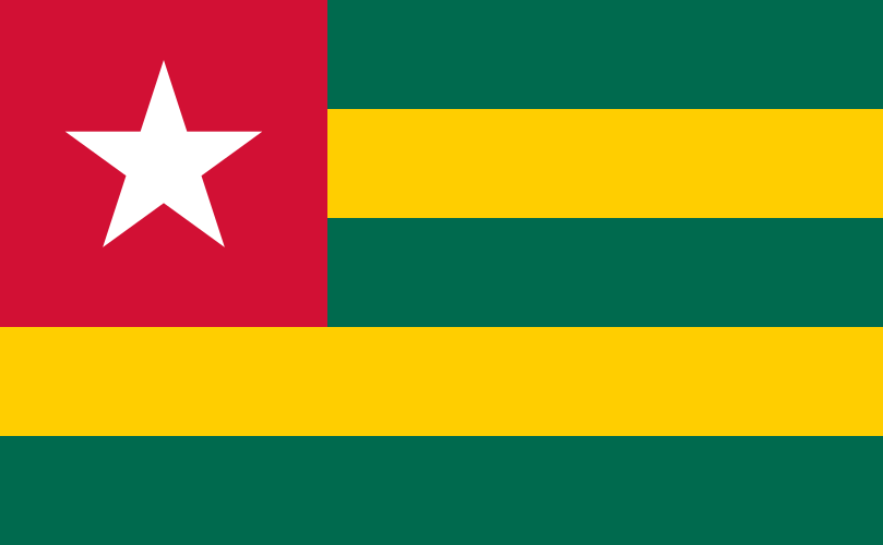 TogoLomé to Dapaong, the Togokomé toll, and the clock change on the way in from Benin.N-Way in Togo →
Driving from Lagos to Accra? About 460 km, three borders and 1,600 F CFA in tolls. Here is what to bring and what to expect.
Lagos to Accra by roadCrossing a border? It tells you before you get there.
The border is a step in your directions, with what to bring. A banner shows from 5 km out and the voice reminds you at 2 km.
- Every post named, and whether it's a joint post or one stop on each side.
- What to bring: passport or ECOWAS papers, yellow fever card, Brown Card for the car.
- Money and language: banks near the post, and a translator before you cross.
- A welcome on arrival: the flag, the capital and the local time, and a note when clocks change.

Built for West African roads
Knows the road before you reach it.
Police ahead. And your rights, one tap away.
Drivers report checkpoints as they pass. You hear “Police ahead” in time, and one tap shows what to do.
- Stay calm, keep your hands visible. Officers should tell you their name and number.
- You don't pay money at a checkpoint. A lawful fine comes with an official receipt.
- Report misconduct to the right body in Nigeria, Ghana, Benin or Togo, with the numbers to call.


Traffic lights, called out before you reach them.
Lights show on the map at street level. As you drive up to one, N-Way tells you how far it is and whether to slow down or get ready to stop.
- “At the traffic light” in the turn, so you know which junction it means.
- Slow down or prepare to stop, with the distance to the light.
- A light that's out? Report it from the map.


On the water, too.
Choose Boat in Directions and N-Way plans the walk to the jetty, the crossing and the way on. Boat routes are a guide: wear a life jacket, and don't travel at night or in bad weather.
- Lagos ferries across the lagoon, from Ikorodu and Badore to CMS, Falomo and Apapa.
- Lake Volta and Lake Nokoué: boats like Yeji–Makango in Ghana and Abomey-Calavi–Ganvié in Benin, with the fare where it's known.
- My own boat: got a boat of your own? N-Way steers you across the water, turn by turn.


Running low? It finds the next filling station.
Tell N-Way your car once. It counts the fuel each trip uses and warns you before you run dry, with a station on your way.
- Litres for every trip, worked out for your car and today's traffic, priced in naira, F CFA or cedis.
- Tolls up front, in naira or F CFA, with routes that avoid them.
- Faster way opens up? One tap to switch, or keep going.


Two hours at the wheel? Time for a break.
On long drives N-Way suggests a stop just ahead: somewhere to eat, a park to stretch your legs, or a hotel when it's late.
- Food, Relax or Sleep, each with the minutes it adds.
- Add stop and the route goes through it.
- Then the last bit on foot, from where you park to the door.


The last bit, on foot. And a look at the way in.
The drive ends where you park. Walking directions take you along the pavement to the door, and Walk View shows the way in before you get there.
- On the pavement: the walker moves beside the road, not down the middle of it.
- Walk View: the walk from the road to the entrance, recorded by people who went, with a 360° look around.
- Film one yourself: N-Way asks as you arrive, and you earn 1,000 points when it’s approved.


N-Way for iPhone · in testing now
Your next turn, without unlocking.
The turn, the road sign and your lane sit on the Lock Screen and in the Dynamic Island while you drive.
- Turn and distance
- Green road signs
- Which lane
- Arrival time


Your week
Every Monday, your week on the road.
Streaks, badges, the places you went and what they cost. Plus one useful thing, like when leaving 40 minutes earlier would have saved you an hour.
- Week streaks and badges for the days you use N-Way.
- Fuel, tolls and traffic for the week, in naira and hours.
- Share it as a picture or a short video.


And everything else a map should do.
A page for every building
Its postcode, entrances, photos and ratings from people who went.

Day and night
A dark map for night driving that follows your phone's setting, with the lights ahead called out.
Your N-Way
Saved places, reports, offline maps and walk views, on this phone or your account.

Advertise with us · businesses in Nigeria, Ghana, Benin and Togo
Your business, on the road to it.
A short billboard shows to drivers heading your way. Its video plays only when they're stopped or slow, and never near a turn. Pay for the days you choose, in your country's money: from GH₵ 45 in Ghana and 2,200 F CFA in Benin and Togo. Online payment for Nigeria and Ghana is coming soon; in Benin and Togo, campaigns are by arrangement with hello@nways.ng.

Your trips stay yours
We don't sell where you go, and ads never get your trip history.
No account needed
Search and drive without signing in. Sign in only to keep places and points on another phone.
Recordings stay on your phone
A checkpoint video is never uploaded unless you choose to back it up.
Delete it all
Remove your account and everything in it at any time. Privacy policy
Where are you going today?
Type a place, a business or a Nigerian postcode. N-Way does the rest, in English or French.
- Coming soon
- Coming soon